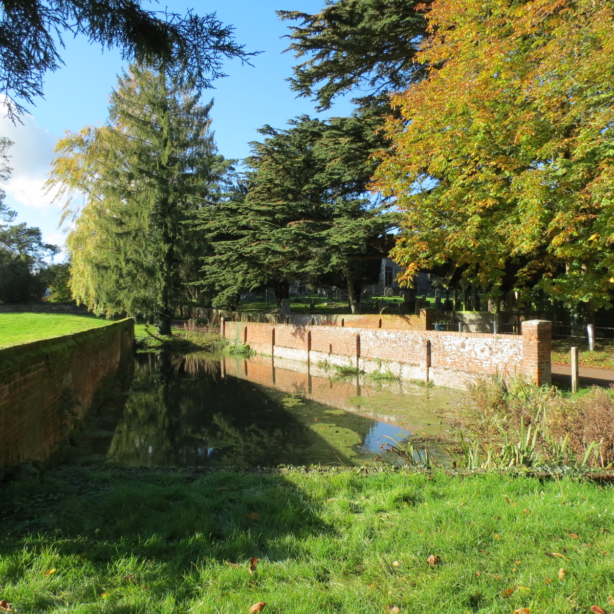
Barkway Carriage Wash
The wagon wash in Church Lane has recently been awarded a protective grade 2 listing by Historic England. As such it has now been correctly described as a carriage wash. Wagon washes across the country are commonplace, but purpose-built carriage washes are rare. It comprises a set of brick enclosing walls, with underwater brick runways. Those carriage washes still in existence are mostly associated with large landed estates.
A wagon wash existed here undoubtedly back at least to the 1600s. The Quin tributary which feeds it was dammed by a southern bank or wall to enable a pond to form. The early Cokenach estate map of 1728 shows the pond, but larger with the lane going through a ford. The stream presumably originally carried on down to the village pond in a southerly direction, whereas following the blocking, the flow was taken through the existing grating and culvert through to the High Street. Having the grill enables easy control of the water levels, a necessary consideration. (An early description records the White Horse inn (no. 82 High Street), as having water on two sides of it).
A Newsells estate map of 1788 shows the lane now with no ford, and the pond as currently. The northern wall would have been raised, and the stream taken through a culvert beneath. A possibly key date and event is the acquiring by the Newsells estate of Manor farm from Cokenach, after 1750. The brickwork of the wash is certainly no earlier than a date of the later 1700s. It is possible that Newsells principally built the wash to maintain their own coaches or provided a service to the several coaching companies operating along the High Street on the busy London to Cambridge route.
As the layout in Church Lane would not seem to have changed since the 1750s, there looks to be not room for a satisfactory turning circle at either end. However, turns could have been made within the Manor Farm yard. The southern containing dam was built presumably along the original line of ownership, and the eventual carriage wall followed the same route. This would explain the walls not being parallel.
Incidentally as an item of interest, in the 1728 map there is a group of cottages around the lych gate which have disappeared by 1780. Contemporary writings refer to derelict cottages at the church gate.